• http://images.china.cn/site1000/2021-11/03/4ee71049-f6a4-4004-8517-ac371b9c75da.jpg
    Aksu Prefecture has been implementing greening projects since 1986. A total of 670,000 volunteers have participated in the planting of 3.9 million trees, reversing desertification of nearly 40,000 square kilometers of land.
    《Green Scenery》   Photo by Li Tao
  • http://images.china.cn/site1000/2021-11/03/917b7008-6494-43b8-ac36-65c37401b287.jpg
    The northern side of Tianshan Mountains is the largest lavender growing area in China and the third largest one in the world. The lavender business has also boosted local tourism and thus contributed to the overall economic growth across the region.
    《A World of Lavender》   Photo by Lai Yuning
  • http://images.china.cn/site1000/2021-11/03/dcb572f5-459d-4219-8b85-c06bb6647ca4.jpg
    Tianshan Mountains, stretching for 1,700 kilometers across northwest China, is a well-known tourist attraction included in the UNESCO World Heritage list. To the north of the mountains lies the most developed area of Xinjiang essential to the development of northwest China.
    《Moon above Tianshan Mountains》   Photo by Han Shuanzhu
  • http://images.china.cn/site1000/2021-11/03/d8b2754e-a800-4c22-8995-9f93886bb384.jpg
    Night view of the deserts in Xinjiang can evoke feelings of mystery and wonder. The soft undulating lines of dunes become clear under the moonlight, enticing visitors to step in and explore.
    《Night in the Desert》   Photo by Li Xueliang
  • http://images.china.cn/site1000/2021-11/06/d31d1f4a-11f4-4629-aee2-cbab0cffa48b.jpg
    Dushanzi Petrochemical, located to the north of Tianshan Mountains, is a primary subsidiary of China National Petroleum Corporation and a key petrochemical base in northwest China. Being among the three earliest oilfields operational in China, Dushanzi is one birthplace of Chinese petroleum industry.
    《Night View of the Oilfield》   Photo by Shen Jiuquan
  • http://images.china.cn/site1000/2021-11/03/ca988859-61eb-4b62-8cb4-850c313d5935.jpg
    Kanas Lake and its surrounding areas on the south side of the Altai Mountains have been the homeland of many nomadic ethnic groups since ancient times. With beautiful scenery and lush forests, it stands as a valuable natural and cultural heritage.
    《Autumn Lake Scenery》   Photo by Li Xueliang
  • http://images.china.cn/site1000/2021-11/03/5a20e5dc-ab13-4c63-aa9d-20cb94a5ed28.jpg
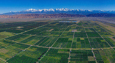
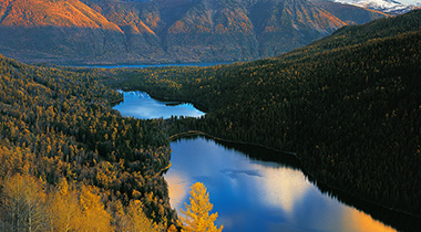
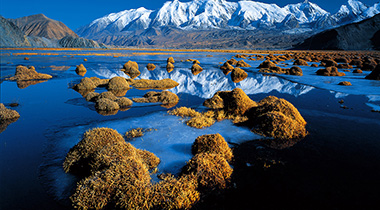
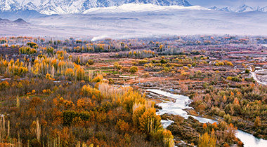
    The Kongur Tiube Peak of the Kunlun Mountains, standing 7,530 meters above sea level, is perennially covered with snow, like a hat worn by a herdsman. For this reason, local herders call it “Kongur Tiube”, meaning a white hat.
    《Kongur Tiube Peak》   Photo by Li Xueliang
  • http://images.china.cn/site1000/2021-11/03/114cd6a9-9bbe-496f-9f61-89f8499ef548.jpg
    In history, the Ancient City of Kashgar, as one of the 36 kingdoms in western China, used to have the name of Shule. It was also among “the four garrison commands of Anxi”. Once a business hub on the ancient Silk Road, it has always been the largest city in southern Xinjiang as well as a center for exchanges between the Eastern and Western civilizations.
    《Ancient City of Kashgar》   Photo by Wang Zhengui
  • http://images.china.cn/site1000/2021-11/03/b946427d-2062-4f35-a59c-e32fae171cde.jpg
    Located in Hotan County of southern Xinjiang, the Moyu River Valley boasts picturesque sceneries. Originating in the Karakoram Range, the river has a total length of 808 kilometers. It was named for the local production of Moyu, which means black jade.
    《Splendid Autumn》   Photo by Adil Nadir
  • http://images.china.cn/site1000/2021-11/03/43090076-87cc-4c2c-a6a7-9725a8a1c845.jpg
    The Tarim Desert Highway is the world’s longest road built on a moving desert. Until its completion, the north and south parts of Xinjiang had been separated by deserts since ancient times. The highway now enables easy transportation and facilitates cultural exchanges.
    《Highway in the Desert》   Photo by Adil Nadir
  • http://images.china.cn/site1000/2021-11/03/f26a96e8-0945-4f09-935c-7a73f00d846c.jpg
    Bagua City in Tekes County, Ili River Valley was established in 1937. Thanks to its shape of “Bagua”, i.e., “Eight Diagrams” formerly used in divination, all traffic lights have been removed from the streets since 1996.
    《The Beautiful Bagua City》   Photo by Qin Jie
  • http://images.china.cn/site1000/2021-11/03/8e880e02-52ad-47b5-8fb0-1a2a996c9dd1.jpg
    The building of Guozigou Bridge on the Lianyungang-Khorgos Expressway in Ili Prefecture was an important project to improve the well-being of the Xinjiang people. Surrounded by clouds and mist, this majestic bridge is a key gateway on the new Silk Road connecting China to Central Asia and Europe.
    《Sky Road》   Photo by Xia Quan
  • http://images.china.cn/site1000/2021-11/03/52876d6b-62f0-4dd5-b54d-30a3450b6ee4.jpg
    Hemu Village is located by the Kanas Lake in Altay Prefecture. Since ancient times, the nomadic Tuvans have lived in this area. In primitive simplicity, their wooden houses cluster in the tranquil village surrounded by birch forests.
    《Hemu Village in Morning Sunlight》   Photo by Xia Quan
  • http://images.china.cn/site1000/2021-11/03/256582ef-3ec3-4a95-8ab6-ce17c7fc9b81.jpg
    Koktokay National Geological Park in Altay Prefecture boasts a diverse collection of landscapes such as canyons, rivers, wetlands and lakes, as well as rich geological and mineral resources. It has been enlisted as a national 5A-level tourist attraction of China.
    《Autumn Wind》   Photo by Jiang Luji
  • http://images.china.cn/site1000/2021-11/03/5ab337f0-bd8e-42e2-96d4-fac21d86e04e.jpg
    Mount Muztagh Atais is located on the east of Pamirs Plateau and the west of Kunlun Mountains. At 7,546 meters above sea level, it is the third highest peak in the western Kunlun Mountains. Its name, Muztag Ata, means “the Father of Ice Mountain” in Uygur language.
    《Mount Muztagh Ata in Moonlight》   Photo by Wu Qiang